FOGAWAY / JOURNAL
Three Cities, One Footprint Map: Keep the Streets in View
A city overview shows where a trip went. Separate street maps show what happened inside each stop. Here is how to read and share both in FogAway.
A map zoomed out to fit several cities can make each day’s walk disappear. Zoom in far enough to see the streets and the other cities leave the frame. A useful trip picture needs both scales.
The images below are actual FogAway share-card output, using constructed walking routes on public roads in New York, Paris and Amsterdam. They are demonstrations, not a record of a journey we took. The dates and figures belong to the example data.
Start with the cities, then look at the streets
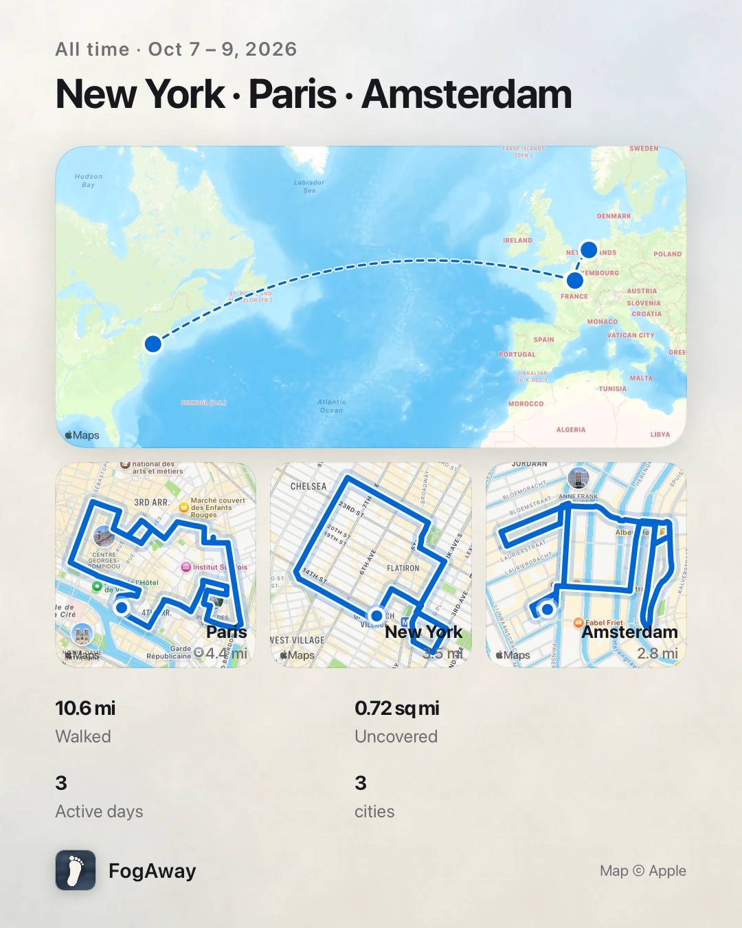
Demo routes. The top map locates the cities; the lower maps retain the local walking detail. This is a still image generated by FogAway.
On this card, the overview gives the trip its geographic shape. The smaller maps answer a different question: where did the walking happen within each city? You can see the street-level paths without squeezing them into one map that spans the whole region.
Read the summary alongside those maps. The example shows three days and three cities. Its distance and explored-area figures describe the recorded example activity; they do not give an itinerary, an airfare distance or a recommendation for how long to spend at each stop.
A single walk needs a closer view
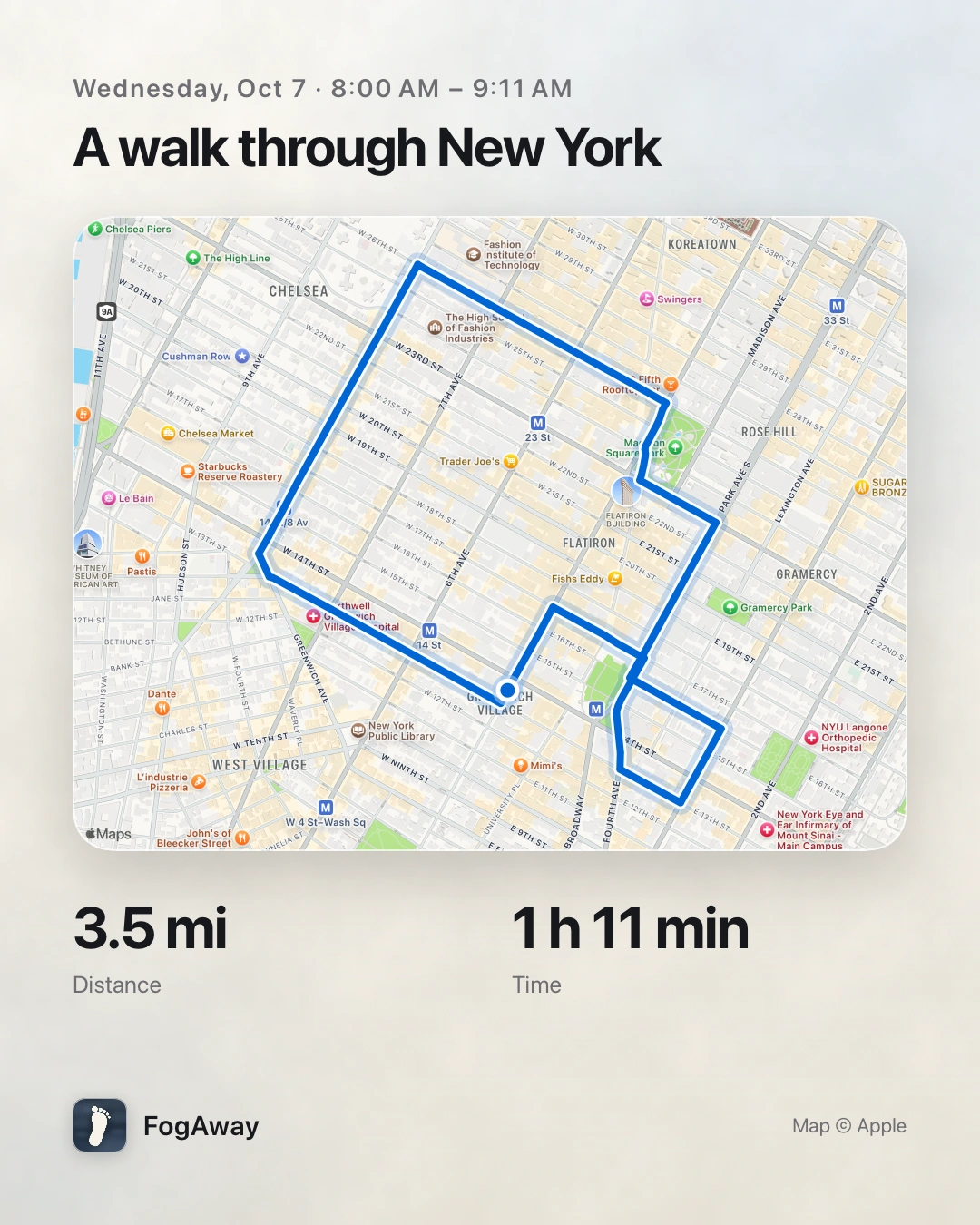
A separate New York demonstration route, exported from the App’s route card. The map and its attribution are part of the original output.
If you only want to share one walk, the route card keeps the map close to that path. Street names help a friend recognise the area; the visible route explains more than a city name alone. These shared route maps leave off the fog so the path remains readable.
For a daily recap, use the day’s card instead. That gives the picture a clear time boundary: this is the day you selected, rather than every place accumulated over a longer period.
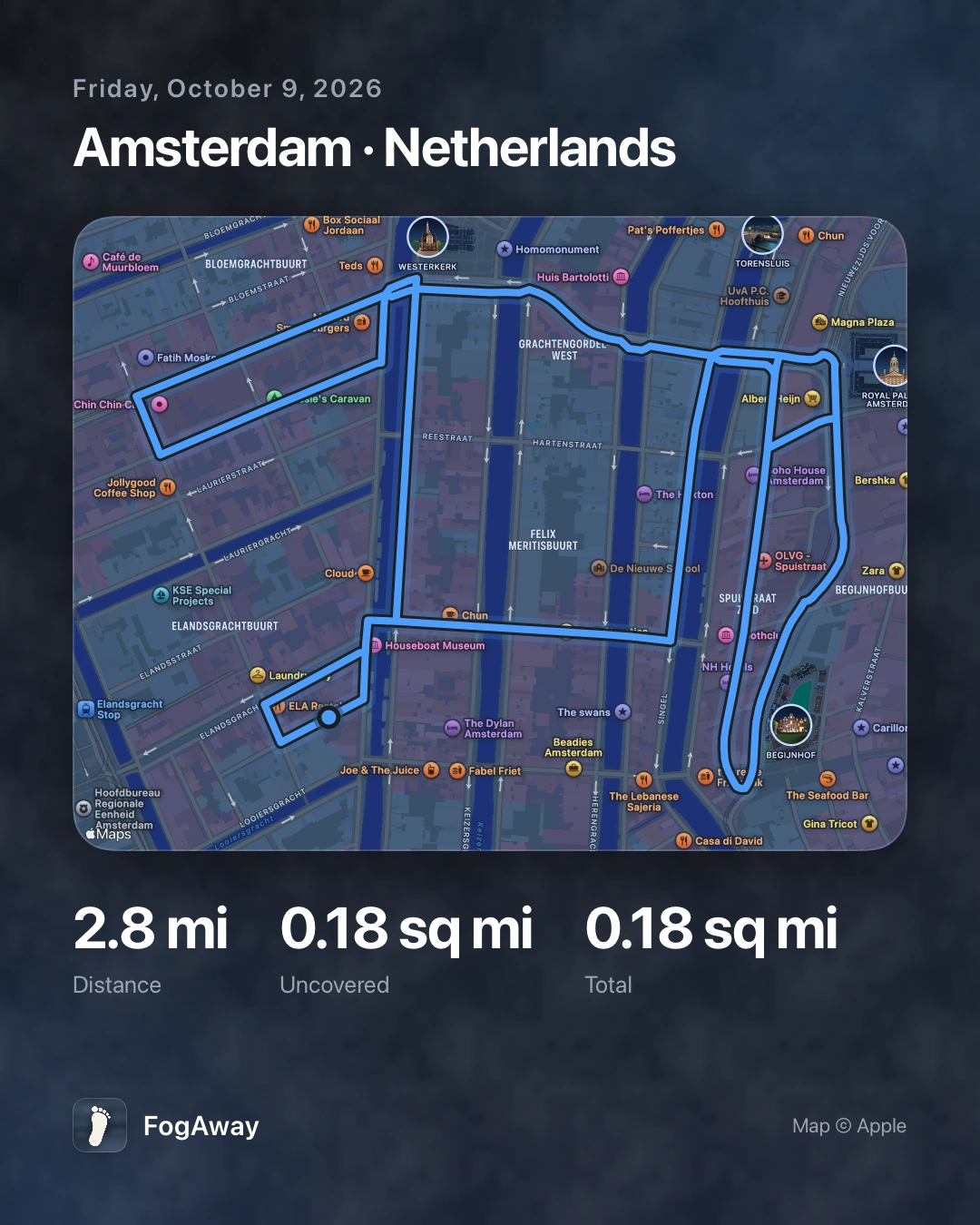
Amsterdam demonstration day. The figures are sample output, not a suggested walking target.
Make the picture match what you want to tell
In FogAway, open sharing from the map and choose the time range you want to show. Preview the resulting map before exporting it. For a single segment, use the option to share one part of the route; for a particular day, open that day in the log and use its share button.
Choose the smallest scope that tells your story. One walk can stand on its own. A day’s card works for a daily recap. A period covering several cities benefits from the overview and city maps together.
Before posting a personal map, check whether its streets reveal a home, workplace or another place you would rather keep private. Share only the period or segment you want others to see, and keep the map attribution intact.
FogAway records and helps you revisit your own footprints. Start with where you actually went, then choose a card that lets someone else see it clearly.